
TECHNOLOGY: An ever changing world
Got something to say? Go for it!
Leave a comment
About Me

Chestnut Esl- Poverty Resources

Featured Posts


MOST VIEWED TODAY
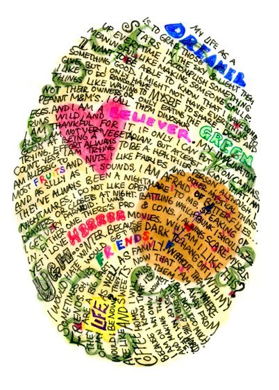
Chestnut Esl/Efl Friends

EFL FOR UPPER SECONDARY STUDENTS by Androniki Nistikaki, Athens, Greece
 Film English Lesson Plans
- B2 ESL Video Lesson Plan: How To Be More Loving
- B2 ESL Video Lesson Plan: The Art of Improvisation
- C1 ESL Video Lesson Plan: Music and Our Brains
- B1 ESL Video Lesson Plan: Designing a Simple Life
- B1 ESL Video Lesson Plan: Weekend Warriors
- B1 ESL Video Lesson Plan: How to Get People to Like You
- C1 ESL Video Lesson Plan: Regaining Our Focus
- B2 ESL Video Lesson Plan: How to Start a Conversation with a Stranger
- B2 ESL Video Lesson Plan: How to Get People to Listen to You
- B1 ESL Video Lesson Plan: The Hidden Power of Your Gut
My That’s English
- How to travel the world with almost no money
- Reading test: Paris canal is officially clean enough to swim in this summer
- Dangerous overcrowding in London homes
- Shakespearean theatre uncovered in London
- Talking point: Culture
- Amsterdam, first city of the modern age
- BBC News summary
- Extensive listening: OK GO, How to find a wonderful idea
- Preparing the EOI B1 and B2 exam with Marek Connel
- How to save money every day
Teen Spirit: A Student’s Blog
- Teen Spirit Changes Hairstyle
- Photos of the month: Savor the season
- Teen Spirit Loves Camden Town, London
- Teen Spirit Loves Photography: It’s Chic!
- Teen Spirit Wears Shorts
- Teen Spirit Icons – Johnny Depp
- Teen Spirit Movie-Snow White And The Huntsman
- Teen Spirit-RED BEAUTY
- Teen Spirit-Floral Craze
- What Is Teen Spirit Cooking Today? Yogurt Dipped Strawberry Hearts!
Newspaper Map

Locate & Read Newspapers from All Around the world


In a search, I found a comment from your web site about my blog MyReadingMapped. However, I could not find the full comment. I was hoping to discover how teachers would use the 33 interactive maps of historic events I have created.
In the past I have found a teacher who was using my Lewis and Clark map to teach his students the importance of writing journals since each of the identified locations on the map integrates with Lewis and Clark’s actual journal entries for each day. Thus, the student can zoom in on the actual location in Google Map, read Lewis and Clark’s journals about what happened that day and how far they traveled. The other explorer maps contain quotes from the explorer’s book; along with the page reference for each location and day. The student can then read online the complete 100+ year old Google Book for free via the link I provided. Thus, the student can read the book and follow it day-by-day on a map they can zoom in on to see the actual locations, buildings and pyramids.
Check out my site map to see a complete list of the historic events covered at http://myreadingmapped.blogspot.com/p/site-map-of-myreadingmapped.html
Thanks to Chestnut ESL, here is what I believe is an interesting student e-lesson by a teacher from New Zealand.
According to MyReadingMapped’s web site analytics, 19 visitors from Auckland, New Zealand all logged on to my Interactive Map of the Travels of Marco Polo at the same time, using the same Internet Service Provider, at 1 PM New Zealand time on Monday, September 5, 2011.
Evidently the teacher first had them do an Internet search for which they entered the following variations:
map of places that marco polo visited
map of places that marko polo visited
map of places marco polo visited
map of place that marco polo visited
the travels of marco polo the book
place marco polo visited interactive map
interactive map of places that marco polo visited
places marco polo visited- interactive map
All of which placed MyReadingMapped’s Marco Polo map within the top 4 searches.
Upon entering my blog, they spent an average of four and a half minutes reading about my site, and the Marco Polo map, and checked out two web pages, before clicking the link under the embedded map to go to the larger original map in Google Maps. Google Maps separate tracking accounted for all 19 of the students.
This interactive map has chapter links for each location Marco Polo visited that are linked to Wikipedia’s Henry Yale translation of The Travels of Marco Polo; and the student can zoom in on the actual location and see photos of the location and view the terrain as well.
Thus, I suspect the students got a lot out of this teacher’s lesson.
I appreciate your feedback, keep up with the excellent work!
The students from New Zealand returned to the Marco Polo map again today. So, I suspect they are getting something out of it. I will track it to see how long it lasts. From what I can tell about 9% return the same day.
It has now been 24 days since the New Zealand students began using the Interactive Map of Marco Polo. In this period, the 20 students generated 78 visits from New Zealand. In this time period, the Marco Polo map has had 132 Pageviews, with 87 Unique Pageviews and is now the leading content of the past 30 days. This page averaged 4 minutes and 52 seconds before jumping the original map on Google Maps; with a Bounce rate of 67%. That Bounce rate means 33% looked at other maps on the web site.
Between 10% and 30% of the students continue to return on a regular basis 24 days after the initial contact. Being a retired marketing manager, I consider this to be an interesting test of the value of interactive maps of historic events as a teaching tool.